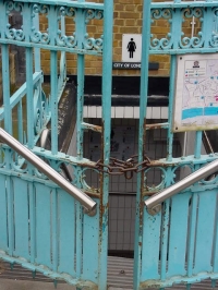
… Wandsworth
September 30, 2010 at 12:43 pm Leave a comment
Open Data on public toilets is slim pickings. The government data website has just one result for public toilets, which comes from Brent (a .kml file), although you only get this if you search for ‘toilets’, not ‘toilet’, grr!
I also found a dataset for disabled toilets in Sutton through their own website. This .csv file lists twice as many toilets than their webpage on public loos does, so that’s some proof that datasets are easier to keep up to date. Although why only publish the disabled ones?
If there are other councils quietly releasing this info then please let me know. I asked my local councillor who got me data for my borough of Wandsworth (and he published it on the internet so it’s now ‘open’ too) with an impressive 56 toilets on it. I wanted to compare this to existing toilet finders, so I created a Google map.
[UPDATE: Hmm I’ve since updated this map for Public Toilets and … Wandsworth Part II, so it now shows far more toilets than it did originally. The council provision just covers the yellow (Superloo) and blue (community toilet scheme) markers.]
SitorSquat is the only modern national toilet app (for mobile, iphones etc) that also has a web version, so I’ve taken a screen grab of this, centred on Wandsworth:
If you use this site then chances are you’re in for a long walk to find a loo.
Once I get my grubby hands on my supervisor Jo-Anne’s iphone I’ll compare the other apps, but SitorSquat is no pansy in this field, with nearly 100 000 loos listed worldwide.
Now despite visiting Wandsworth’s devilish website dozens of times this year I’ve just found that they too have a Google map of their toilets, double grr!
Clearly they’re funding an impressive number of facilities, so why not tell people about it? Community Toilet Schemes such as this are catching on, but they include such a long and random list of businesses that it’s impossible to remember who’s in and who’s out. Providing data so that it can be added to 3rd party apps would change that.
But hang on, Wandsworth have provided a map, so isn’t that enough? Well if you needed the loo what’s the first thing you’d do? Check the council website?
In any case it didn’t take me long to realise that Wandsworth’s map was out of date and some of the markers were in the wrong place. In fact I found a council report from June that had a different list of businesses altogether, so maybe my map’s wrong too!
Constantly updating a Google map will not solve the problem. Would releasing local council data for others to use help people find the loo, or are there unforseen problems here too.
What do you think?
Entry filed under: Open Data. Tags: Community Toilet Scheme, Maps, Open Data, Public Toilets, SitorSquat, Wandsworth.


Trackback this post | Subscribe to the comments via RSS Feed